Topic

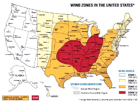
Wind Zones in the United States

Topic Progress:

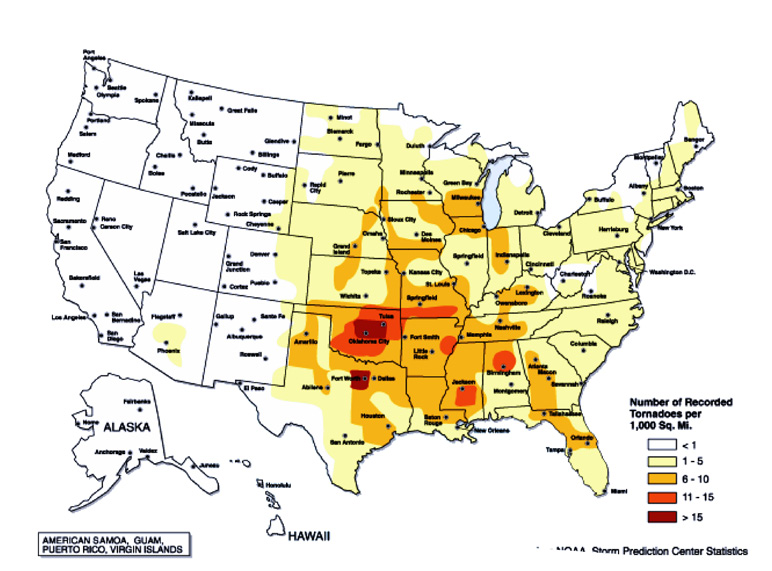
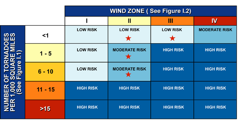
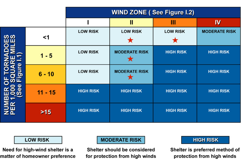
To complete the worksheet on the back of this page, refer to the tornado and wind zone maps on pages 3 and 6 (Figures I.1 and I.2). Using the map on page 3, note how many tornadoes were recorded per 1,000 square miles for the area where you live. Find the row on the worksheet that matches that number. Next, look at the map on page 6 and note the wind zone (I, II, III, or IV) in which you live. Find the matching column on the worksheet. Finally, find the box inside the worksheet that lines up with both the number of tornadoes per 1,000 square miles in your area and your wind zone. The color of that box tells you the level of your risk from extreme winds and helps you decide whether to build a shelter.

For example, if you live in Jackson, Mississippi, you would see that Jackson is in an area shaded medium orange on the map on page 3. So according to the map key, the number of tornadoes per 1,000 square miles in the Jackson area is 11 – 15.
Jackson appears within the red-shaded area. The map key tells you that Jackson is in Wind Zone IV.
The box where the 11-15 row and the Zone IV column meet is shaded dark blue, which shows that you live in an area of high risk. A shelter is the preferred method of wind protection in high-risk areas. Note that some areas of low or moderate risk, shown as pale blue or medium blue in the worksheet, are within the region of the United States that is subject to hurricanes (see Figure I.2). If you live in this hurricane-susceptible region, your risk is considered high, even if the worksheet indicates only a moderate or low risk.
Shelter is preferred method of protection from high winds if house is in hurricane-susceptible region